James Saunders
Guest Reporter
Britons already bracing for a harsh start to 2025 have been told to look out for even worse conditions after the Met Office updated yesterday's wide-ranging weather warnings.
On Sunday forecasters issued a spate of yellow weather warnings for rain, snow, ice and wind - and now, a rare amber alert has been put in place for parts of Scotland.
From midnight tonight to 5pm tomorrow, residents a stretch of Scotland from Inverness to Fort William have been told to prepare for "property flooding and travel disruption" - with some communities facing a "good chance" of being cut off entirely, the Met Office says.
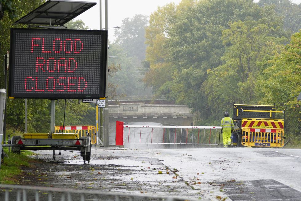
Alongside delays and cancellations to trains and buses, homes and businesses alike could face floods and power cuts on the final day of 2024.
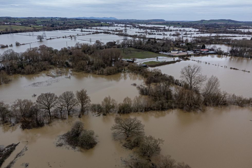
Meteorologists have said that heavy rain is "expected to develop during Monday night and persist through Tuesday morning before turning to showers on Tuesday afternoon, giving another 50-70mm on top of what has already fallen".
It comes as part of what the Met Office has already labelled a "very complicated" forecast for much of Britain heading into 2025.
The bureau's chief forecaster Andy Page said: "There is a very complicated weather forecast for the UK with snow, strong winds and heavy rain all featuring for parts of the UK.
"Almost the entire UK is covered by at least one weather warning during the coming week.
LATEST WEATHER UPDATES FROM GB NEWS:
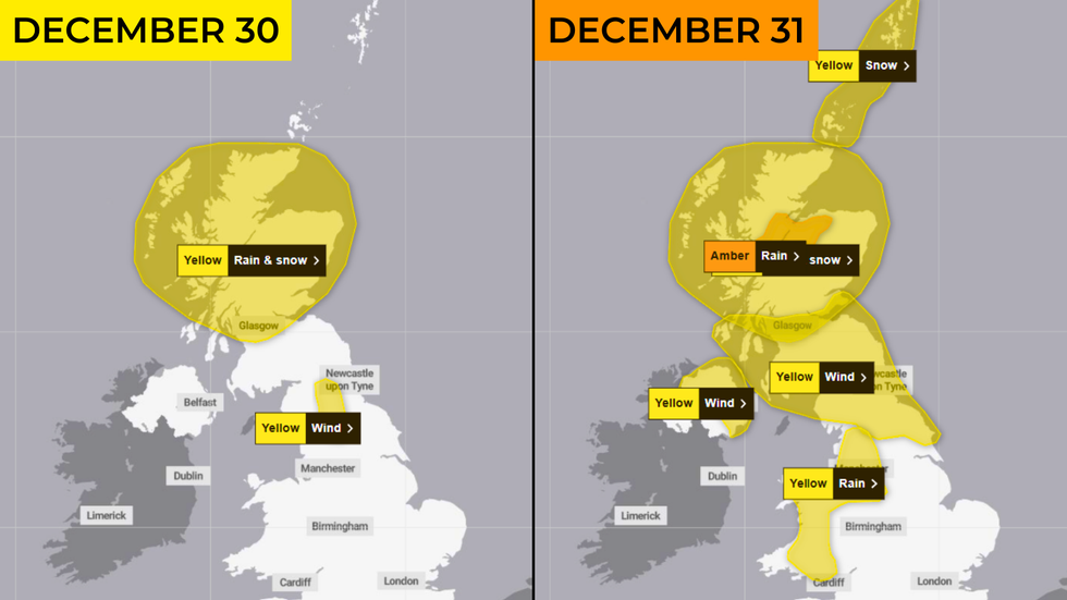
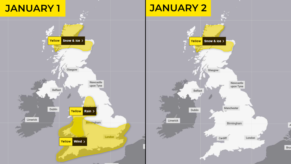
"With such a varied and complex weather situation there is potential for the pattern of warnings to shift and possibly escalate in some areas.
"With lots of celebrations and people on the move over the coming days, we are urging everyone to keep checking the forecast so they can update their plans."
The Met Office has also laid out a broad range of predictions for New Year's Day itself.
January 1 will begin with snow affecting parts of Northern Ireland, southern Scotland and northern England as an area of low pressure moves eastwards across the UK and encounters colder air, forecasters say.
The bureau's deputy chief forecaster Tony Wisson said: "Locally, there could be accumulations of 10-15cm of snowfall, with larger amounts over the higher hills, and with associated strong winds we could see drifting snow in some parts."
While across much of England and Wales, those bringing in the new year may have to batten down the hatches as strong winds are expected to strike.
These areas are covered by a yellow wind warning on both Wednesday and Thursday (January 1 and 2), heralding gusts of up to 65-75 mph in exposed locations.
Find Out More...
On Sunday forecasters issued a spate of yellow weather warnings for rain, snow, ice and wind - and now, a rare amber alert has been put in place for parts of Scotland.
From midnight tonight to 5pm tomorrow, residents a stretch of Scotland from Inverness to Fort William have been told to prepare for "property flooding and travel disruption" - with some communities facing a "good chance" of being cut off entirely, the Met Office says.
Alongside delays and cancellations to trains and buses, homes and businesses alike could face floods and power cuts on the final day of 2024.

Meteorologists have said that heavy rain is "expected to develop during Monday night and persist through Tuesday morning before turning to showers on Tuesday afternoon, giving another 50-70mm on top of what has already fallen".
It comes as part of what the Met Office has already labelled a "very complicated" forecast for much of Britain heading into 2025.
The bureau's chief forecaster Andy Page said: "There is a very complicated weather forecast for the UK with snow, strong winds and heavy rain all featuring for parts of the UK.
"Almost the entire UK is covered by at least one weather warning during the coming week.
LATEST WEATHER UPDATES FROM GB NEWS:
- UK weather: Britain COULD see a White New Year - 'Wintry showers could be on the way!'
- UK weather: Britain braces for snow and icy winds as bitter Arctic blast looms
- Festive travel chaos erupts at key UK airports as fog grounds flights across Britain


"With such a varied and complex weather situation there is potential for the pattern of warnings to shift and possibly escalate in some areas.
"With lots of celebrations and people on the move over the coming days, we are urging everyone to keep checking the forecast so they can update their plans."
The Met Office has also laid out a broad range of predictions for New Year's Day itself.
January 1 will begin with snow affecting parts of Northern Ireland, southern Scotland and northern England as an area of low pressure moves eastwards across the UK and encounters colder air, forecasters say.

The bureau's deputy chief forecaster Tony Wisson said: "Locally, there could be accumulations of 10-15cm of snowfall, with larger amounts over the higher hills, and with associated strong winds we could see drifting snow in some parts."
While across much of England and Wales, those bringing in the new year may have to batten down the hatches as strong winds are expected to strike.
These areas are covered by a yellow wind warning on both Wednesday and Thursday (January 1 and 2), heralding gusts of up to 65-75 mph in exposed locations.
Find Out More...
